Log in
All resources
Create a design
887 Free Artworks of Old Maps Of France
bibliothèque nationale de france
maps from gallica
maps of paris from bibliothèque nationale de france
maps with cartouches
cartes de franz schrader
franz schrader
maps by pieter van der keere
maps of spain by tomas lopez
maps by willem and johannes blaeu
maps by alexis-hubert jaillot
maps from gallica
old maps of genoa
historisk atlas (stockholm, norstedt & söner, 1880)
old maps of the polish-lithuanian commonwealth
maps in the rijksmuseum amsterdam
published by frans buffa & zonen
1610s maps of the netherlands
old maps of friesland
19th-century maps of vaucluse
1852 maps of france
cartes de franz schrader
old maps of kolkata
maps of paris by louis-joseph mondhare
maps of paris from paris musées
maps with cartouches
old maps of yunnan
tresor des cartes geographiques (1659)
old maps of the benelux
maps of paris from bibliothèque nationale de france
nouveau plan de paris by louis brion de la tour
maps of paris from bibliothèque nationale de france
bird's eye view maps of paris
lucas janszoon waghenaer
bretagne in the 1580s
maps of aire-sur-la-lys city walls
old maps of aire-sur-la-lys
maps of paris from paris musées
plan de roussel
maps in the british museum
1780s maps of france
cartes de franz schrader
1894 maps of france
enceinte of philippe-auguste on old maps
1610s maps of paris
old maps of algiers
maps from gallica
old maps of algiers
maps from gallica
landais & oberthur
maps from gallica
maps of paris from bibliothèque nationale de france
nouveau plan de paris by louis brion de la tour
cartes de franz schrader
old maps of algeria
maps by pieter van der keere
1600s maps of norway
novus atlas sinensis
old maps of sichuan
maps of brest, france by antoine aveline
17th-century maps of brest
maps of paris from bibliothèque nationale de france
maps of paris by braun & hogenberg
maps of paris from bibliothèque nationale de france
ludovic baschet
old maps in the bibliothèque nationale de france
old maps of the holy roman empire
old maps of bordelais
maps of médoc
old maps of brabant
1666 in belgium
maps of paris from bibliothèque nationale de france
dheulland map of paris
old maps of bouvet island
bouvet island
old maps of former departments of france
maps from gallica
old maps of former departments of france
maps from gallica
old maps of french guiana
old maps of venezuela
old maps of the strait of gibraltar
1762 maps of spain
old maps of the bay of gibraltar
18th-century maps of gibraltar
turgot map of paris – derivative files
château de la tournelle (paris)
maps made in the 15th century
old maps of france
maps from the portail des bibliothèques spécialisées de la ville de paris
maps from the bibliothèque historique de la ville de paris
architectonographie des théâtres de paris
maps of paris in the 1830s
novus atlas sinensis
old maps of jiangxi
maps of spain by tomas lopez
old maps of guadeloupe
old maps of heraklion
baroque
old maps of the northern hemisphere
old maps of the arctic
maps from the mechanical curator collection available to georeference
maps from the mechanical curator collection
old maps of the republic of genoa
maps of the duchy of milan
atlas - voyage pittoresque à l'île-de-france, au cap de bonne-espérance et à l'île de ténériffe (1812) by milbert
maps from the mechanical curator collection
old maps of the environments of paris
maps by alexis-hubert jaillot
17th-century maps of south asia
maps by alexis-hubert jaillot
maps of spain by tomas lopez
1760 maps of spain
historisk atlas (stockholm, norstedt & söner, 1880)
old maps of the carolingian empire
lutetia parisiorum urbs, toto orbe celeberrima notissimaque caput regni franciæ by sebastian münster
maps of paris from bibliothèque nationale de france
lutetia parisiorum urbs, toto orbe celeberrima notissimaque caput regni franciæ by sebastian münster
maps of paris from bibliothèque nationale de france
maps by alexis-hubert jaillot
old maps of toulouse
novus atlas sinensis
old maps of guangxi
old maps of the bahamas
lucayas
old maps of rennes
adolphe périaux
old maps of cities in asturias
1777 maps of spain
maps in the library of congress
old maps of france
atlas - voyage pittoresque à l'île-de-france, au cap de bonne-espérance et à l'île de ténériffe (1812) by milbert
maps from the mechanical curator collection
old maps of leiden
baroque
old maps of regions of france
pierre françois tardieu
maps of moers by johannes mercator
old maps of duisburg
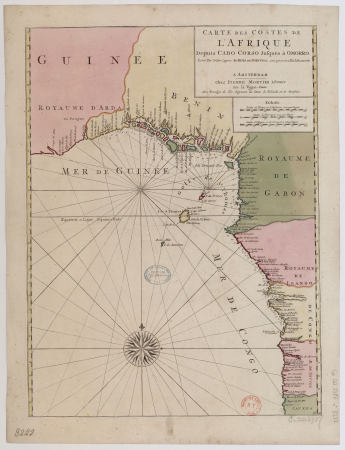
17th-century maps of africa
maps from gallica
bibliothèque municipale de reims, rès. g 152
1656 maps of france
1690s maps of france
old maps of orléans
tresor des cartes geographiques (1659)
old maps of tunis
maps of paris from paris musées
maps of paris by jean lattré
cartes de franz schrader
old maps of algiers
old geological maps by jean-etienne guettard
jean étienne guettard
1600s maps of belgium
old maps of flanders
maps by pieter van der keere
willem barentsz
maps by pieter van der keere
old maps of utrecht
17th-century maps of mecklenburg-vorpommern
johann lauremberg
old maps of périgueux
1660s maps of france
maps of asia by jean-baptiste bourguignon d'anville
french-language maps
demographic maps of algeria
cartes de franz schrader
maps of spain by tomas lopez
1779 maps of spain
maps of spain by tomas lopez
old maps of lanzarote
maps of paris from the david rumsey historical map collection
maps of île-de-france by françois de la guillotière
cartes de franz schrader
old maps of the alps
17th-century maps of cambridgeshire
old county maps of cambridgeshire
maps of paris from bibliothèque nationale de france
plan de roussel
old maps of ischia (island)
giulio jasolino
maps in the library of congress
old maps of france
barcelona in the 1800s
maps by juan lopez
maps by tomas lopez
1785 maps of africa
cartes de franz schrader
maps of algeria by theme
maps of france by hendrik hondius
old maps of cambrai
old maps of toledo, spain
1580s maps of spain
old maps of the bay of gibraltar
18th-century maps of gibraltar
old maps of norway
guillaume sanson
old maps of norway
guillaume sanson
maps by pieter van der keere
old maps of basel
old maps of finistère
maps from gallica
1852 maps of france
old maps of isère
landais & oberthur
maps from gallica
maps from géographie illustrée de la france et de ses colonies
old maps of rhône
maps of the islands of greece by marco boschini (1658)
old maps of skiathos
301 - 400 of 887
Next page
/ 9


![Treasure of geographical maps of the main states of the universe [...], 1659](https://cdn.creazilla.com/illustrations/10000541161/treasure-of-geographical-maps-of-the-main-states-of-the-universe-1659-md.jpg)


![Map of Bourdelois, the country of Medoc, and the provostship of Born / [Blaeu], 1635](https://cdn.creazilla.com/illustrations/10001341609/map-of-bourdelois-the-country-of-medoc-and-the-provostship-of-born-blaeu-1635-sm.webp)


![Topographical Map of the Department of Montenotte / Written by the care of Mr. Count de Chabrol Prefect. Scale of 10,000 Meters [=Om. 050; 1: 200,000]; Drawn by Cecchi, geographer, between 1806 and 1812](https://cdn.creazilla.com/illustrations/10000562582/topographical-map-of-the-department-of-montenotte-written-by-the-care-of-mr-count-de-chabrol-prefect-scale-of-10000-meters-om-050-1-200000-drawn-by-cecchi-geographer-between-1806-and-1812-sm.webp)
![Topographical Map of the Department of Montenotte / Written by the care of Mr. Count de Chabrol Prefect. Scale of 10,000 Meters [=Om. 050; 1: 200,000]; Drawn by Cecchi, geographer, between 1806 and 1812](https://cdn.creazilla.com/illustrations/10000886036/topographical-map-of-the-department-of-montenotte-written-by-the-care-of-mr-count-de-chabrol-prefect-scale-of-10-000-meters-om-050-1-200-000-drawn-by-cecchi-geographer-between-1806-and-1812-sm.jpg)


![Plan of the circle battle between the U.S. ship "Keasarge," Capt. Winslow, and the Confederate cruiser "Alabama," Capt. Raphael Semmes, off the harbor [of] Cherbourg, France: forenoon of Sunday June 19th 1864., 19 June 1864](https://cdn.creazilla.com/illustrations/10000851176/plan-of-the-circle-battle-between-the-us-ship-keasarge-capt-winslow-and-the-confederate-cruiser-alabama-capt-raphael-semmes-off-the-harbor-of-cherbourg-france-forenoon-of-sunday-june-19th-1864-19-june-1864-md.jpg)


![Treasure of geographical maps of the main states of the universe [...], 1659](https://cdn.creazilla.com/illustrations/10000832962/treasure-of-geographical-maps-of-the-main-states-of-the-universe-1659-md.jpg)


![[Map of the defeat of the Confederate ship Alabama by the U.S. steamer Kearsarge on June 19, 1864, off Cherbourg, France].](https://cdn.creazilla.com/illustrations/10001534884/map-of-the-defeat-of-the-confederate-ship-alabama-by-the-us-steamer-kearsarge-on-june-19-1864-off-cherbourg-france-md.jpg)


![Topographic map of the south-western slope of Menez-haut / surveyed and drawn up [...] by AM Kamelin, 1849](https://cdn.creazilla.com/illustrations/10001387383/topographic-map-of-the-south-western-slope-of-menez-haut-surveyed-and-drawn-up-by-am-kamelin-1849-sm.webp)

